Walking pack · PDF + GPX download
The Best Malvern Hills Walks & GPX Pack
The best routes on the hills in one offline-friendly pack, with GPX files for your phone.
- 9 walks
- 9 GPX files
- Print or phone
- Built from checked data
Available soon.
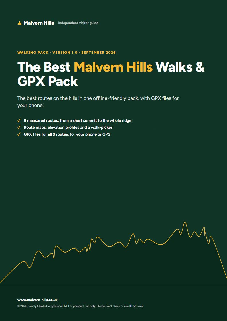
Our best measured routes gathered into one download: a comparison table and walk-picker, a printable summary card for every route with its map and elevation profile, and GPX files to load into your phone or GPS so you can walk without signal.
What’s inside
- The best measured routes, from a short summit to the whole ridge
- A walk-picker table: distance, climb, time, difficulty and best for
- A printable card per walk: route map, elevation profile, start, parking and planning notes
- GPX files for every route in the pack
- Offline checklist and how to load GPX files onto your phone
- Safety and responsible walking guidance (also free on the site)
- QR codes to each live route page
Who it’s for
- Walkers who want to choose their own routes
- Anyone who wants the routes offline, on a phone or GPS
- Repeat visitors ticking off the summits
Formats
PDF (A4, print and screen) · GPX route files
Sample pages
The 9 walks in this pack
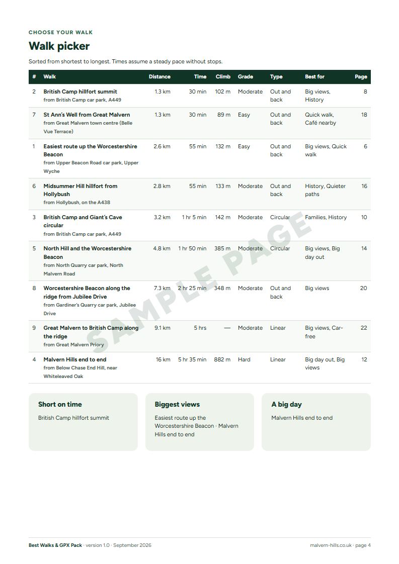
| Walk | Distance | Time | Grade | GPX |
|---|---|---|---|---|
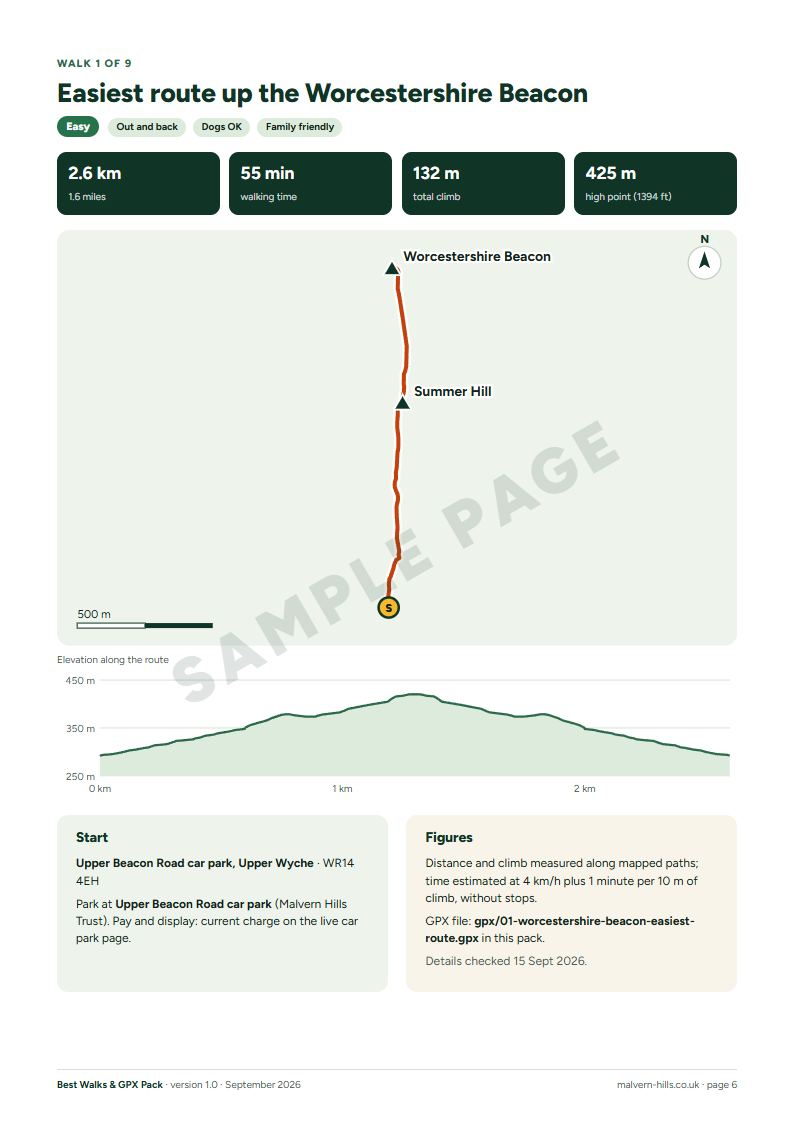
| Easiest route up the Worcestershire Beacon | 2.6 km | 55 min | Easy | Yes |
| British Camp hillfort summit | 1.3 km | 30 min | Moderate | Yes |
| British Camp and Giant’s Cave circular | 3.2 km | 1 hr 5 min | Moderate | Yes |
| Malvern Hills end to end | 16 km | 5 hr 35 min | Hard | Yes |
| North Hill and the Worcestershire Beacon | 4.8 km | 1 hr 50 min | Moderate | Yes |
| Midsummer Hill hillfort from Hollybush | 2.8 km | 55 min | Moderate | Yes |
| St Ann’s Well from Great Malvern | 1.3 km | 30 min | Easy | Yes |
| Worcestershire Beacon along the ridge from Jubilee Drive | 7.3 km | 2 hr 25 min | Moderate | Yes |
| Great Malvern to British Camp along the ridge | 9.1 km | 5 hrs | Moderate | Yes |
Each walk links to its free page on this site. The pack organises them into a printable, offline-friendly format with maps, profiles and planning notes.
What it is, and what it isn’t
- Built from the same checked records as this website, with the date each walk was last checked.
- Route maps and overviews, not turn-by-turn directions. Take a paper map.
- Safety guidance is included, and it’s also free on the site: you never need to buy a pack to walk safely.
- Things that change (parking charges, opening times, weather) point to the live pages by QR code.
- No business has paid to appear in the packs.
Questions
Isn’t all this free on the website?
The walk pages, parking and safety information are free, and always will be. The pack saves you the planning: the right walks chosen for you, organised into a plan, with printable cards, maps, GPX files and checklists in one download that works without signal.
Does it have turn-by-turn directions?
No. Each walk has a route map, an overview and the key facts. We only publish step-by-step directions once we’ve walked a route ourselves. Take a paper map and follow the paths and signs on the ground.
How do I get it?
Pay securely through our payment provider and you’ll get a download link straight away, on screen and by email. The download is a ZIP file with the PDF, a printable checklist and GPX files where the pack includes them.
What about refunds?
Because it’s a download, you agree at checkout that it starts straight away, which ends the usual 14-day cancellation period. If a file is faulty, won’t open or isn’t as described, email us and we’ll fix it or refund you.
Will it go out of date?
Anything that changes, like parking charges and opening times, isn’t printed as fact: the pack links to the live pages. When a route changes, we update the pack.
Can I use the GPX files on my phone?
Yes: 9 routes in this pack have a GPX file. Import them into your mapping app and download the offline map before you go.